 EMODnet Product Catalogue
15 meter
Type of resources
Available actions
Topics
Keywords
Contact for the resource
Provided by
Years
Formats
Representation types
Scale 1:
Resolution
-
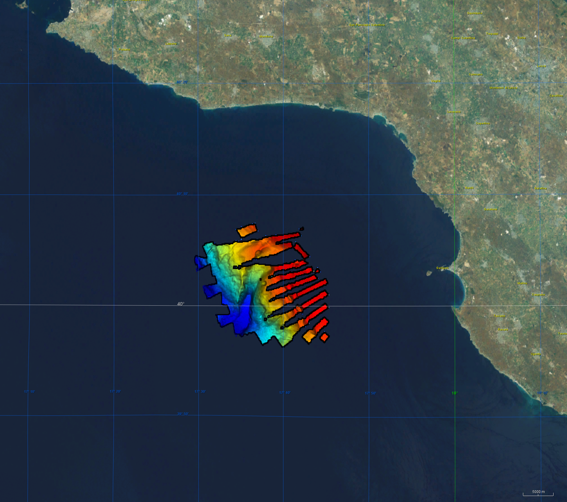
Bathymetry data was acquired during R/V Meteor cruise M144/1 in the aegean region of the Mediterranean Sea between 27.12.2017 and 18.01.2018. The cruise aimed to clarify the causal links between climate and ecosystem change on the one hand by sociocultural evolution on the other hand by climatic and environmental change that can be aligned with the archeological record. CI Citation: Paul Wintersteller (seafloor-imaging@marum.de) as responsible party for bathymetry raw data ingest and approval. Description of data source: During the M144/1 cruise, the hull-mounted KONGSBERG EM122 multibeam ecosounder (MBES) was utilized to perform bathymetric mapping in medium to deep waters. Two linear transducer arrays in a Mills Cross configuration transmit acoustic signals of a nominal sonar frequency of 12 kHz. With 432 soundings per swath, the emission cone has a dimension of max 150° across track and 1° along track. With a reception obtained from 288 beams, the actual beam footprint is 1° by 2°. Depending on the roughness of the seafloor and the water depth, the swath width on a flat bottom is maximum six times the water depth. For further information on the system, consult https://www.km.kongsberg.com/. The position and depth of the water column is estimated for each beam by using the detected two-way-travel time and the beam angle, ray-traced through the water column, utilizing a proper sound speed profile. Throughout this cruise the swath width was mainly at 120° and did not exceed 130°. Responsible person during this cruise / PI: unstated.